On January 7th we left No Name Harbor just as the sky began to lighten. As the sun rose above the horizon we were clearing the last channel markers off of Cape Florida. A few boats were ahead of us and as we went a few more appeared behind us. There were about 10 boats visible in total.
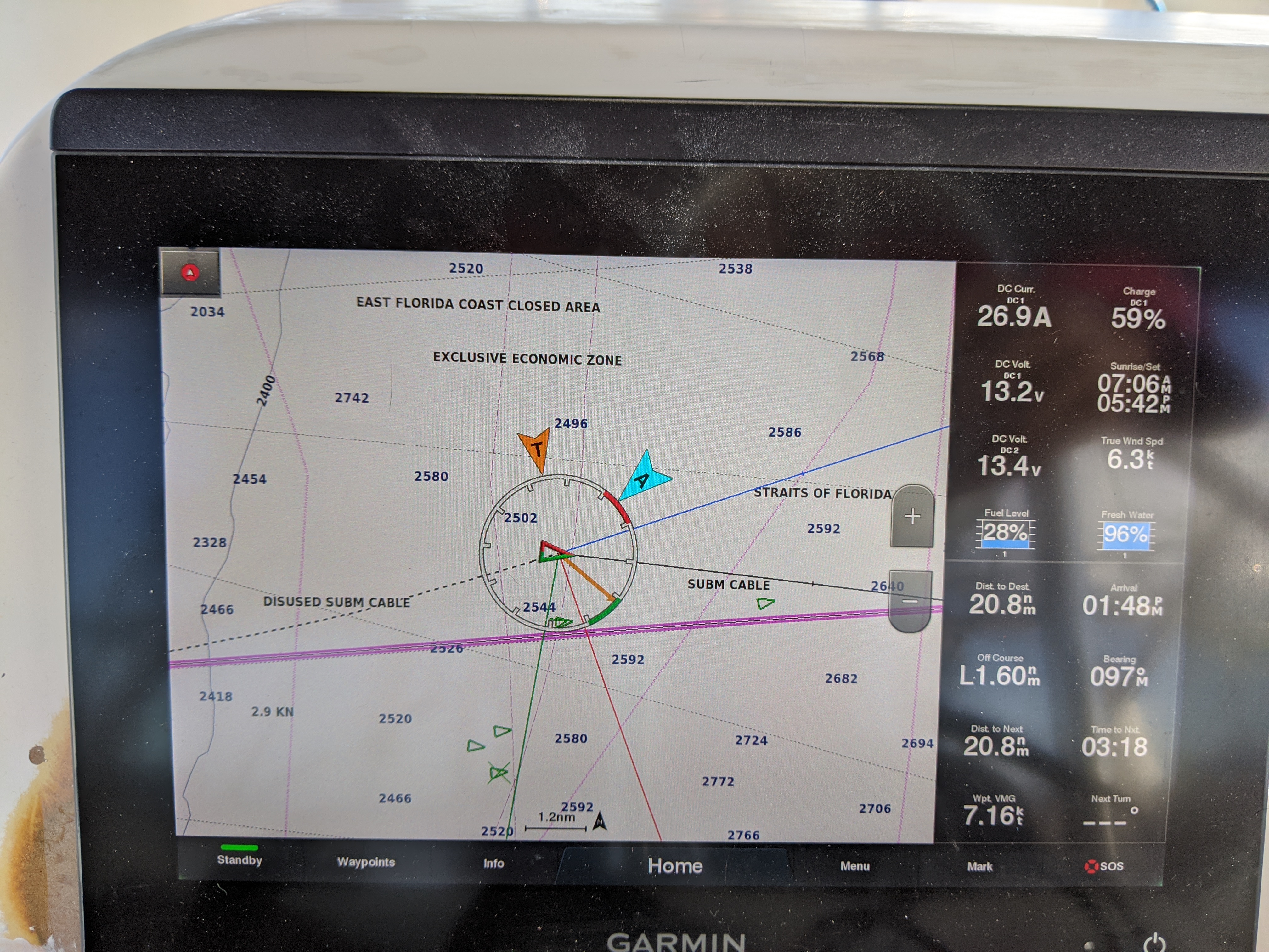
We held a course maybe 20 degrees south of straight towards Bimini in order to make a little headway south before reaching the Gulf Stream which would swiftly carry us north. I don't remember the exact characteristics of the Stream that day but let's just say that about 5 miles out it became strong, so I altered course to maybe only 5 degrees south of straight east (yes, that would be 95 degrees). I altered the settings of the chart plotter so that lines indicating both heading (direction the boat is pointed) and track (direction of boat movement over ground) angles emanated from our location marker. It was interesting to see them differ by 15 degrees or so due to the combined current and boat movement through water.
The chief risk of crossing the Stream is that you end up heading so far south to keep from drifting north that you don't make much speed in the east/west direction, making the trip much different than planned. This was almost not a concern for us since we started somewhat south of where we needed to be. But still, I figured it was most efficient to get out of the Stream as quickly as possible, hence the almost straight east heading. And after we got out of the Stream I could make up a couple of miles to the south without needing to motor against the current. I didn't dream this strategy up on my own; it is described in the Explorer Chart books.
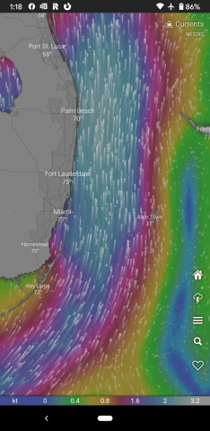
All the other boats seemed to be steering whatever heading would keep them on a line drawn straight between No Name Harbor and Bimini (again, not a big deal for a destination that is a little north of your start anyways). With our almost straight east heading we drifted a few miles north of the main group of boats, crossed paths with SV Make Way and SV Twin, and drifted a mile or so north of them. At that point we were within about five miles (I think?) of Bimini and I was surprised that the current still had not really abated. The current ended up holding pretty strong until just one or two miles out so my plan of making up southerly distance out of the current yield any real advantage. But we arrived in Bimini at about the same time (2:00pm?) as the other boats anyways. (When I took the screenshot of the currents in the Windy app for this article I realized that it probably typical, I just didn't remember to look at the currents forecast that day.)
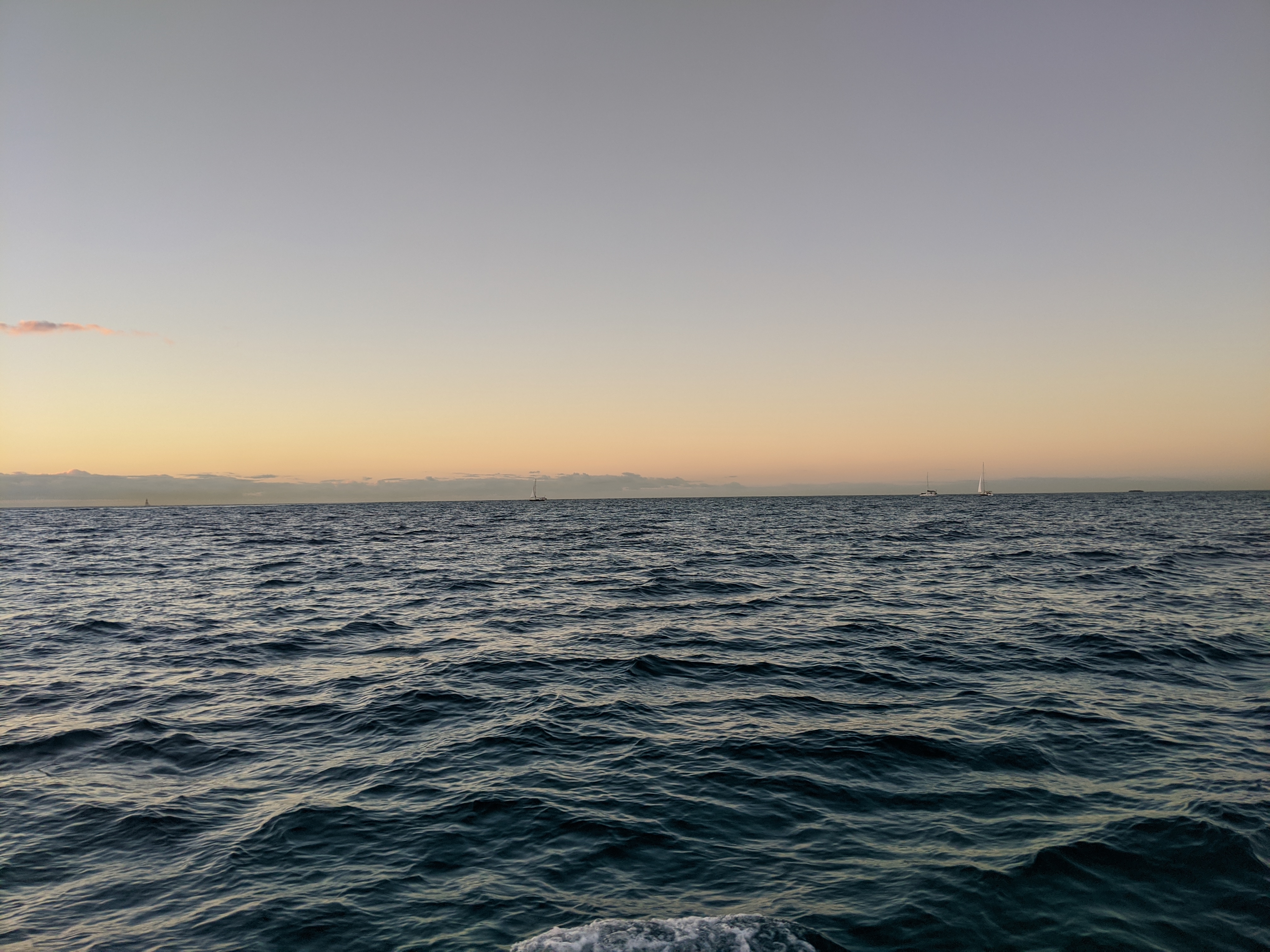
For the crossing we had a great breeze that would probably have let us sail at 5.5-6 knots but we motored at about 50% throttle too to put us at a solid 7 knots (IIRC). When we started out in the morning there were some 2-3 foot waves coming from the north so it was a little bouncy but we did fine. Those died down later in the morning so overall we had really nice conditions.
On the final approach to the island of South Bimini we followed another sailboat; they bumped a sandbar and backed off. So we followed their new route and made it through the very narrow approach through the small jetties into the Bimini Sands Marina. It was pretty shallow at one point in that channel, just shy of six feet maybe half an hour after low tide. But we made it and docked successfully. They had a rate of $150 for a week so we planned to stay there for that long as the wind was forecast to blow strongly out of the east for several days...and we wanted to go east!
I took a shuttle bus to the airport a couple miles away and went through customs and immigration for myself, Anna, Louise, and the boat. Once I got back about two hours later Anna and Louise were able to finally step on shore.
- Log in to post comments